Welcome to SIMP, Where you Map View Analyze Biocontrol Data
SIMP is a nationally recognized and adopted platform for performing analysis on biocontrol release sites. The data captured is used to document vegetation cover, target weed density, and biological control agent abundance. When conducted annually, this monitoring data will document changes that occur over time.
Map
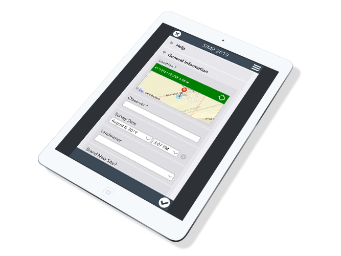
Utilizing Survey 123 and our SIMP app land managers can record and map all of their data. We even have web based forms for past years entries.
View
All data is synced to the online map below for immediate view. See your sites and overlay them with existing map layers.
Analyze
Use the built in tools to perform site analysis comparing years. Compare insect numbers, desirable cover, target weed cover and more with custom built graphs and charts.
Monitoring forms
Monitoring biological control agents is an essential component of a successful biological control program. Capturing this data helps us accurately document the impact of this weed management practice. Learn more about the permanent monitoring system .
Data Entry Form
Use our online form to enter in your data directly from your computer. Have data that needs to get entered from past years? This online form is the solution. Just select the browser option from the link below.